- FREE DELIVERY ON ORDERS OVER R1000
- Working Hours: Monday - Friday: 9am - 4:30pm


from
R290.00 incl.
EXCELLENTTrustindex verifies that the original source of the review is Google. This is the second time that I have ordered wallpaper from Waalpaper online! I love the quality, designs and speed of delivery! Great product!Posted onTrustindex verifies that the original source of the review is Google. A great DIY product with numerous uses. The only negative is that I ran out of places to stick it to and still have left. But I will find more walls, wardrobes, doors, etc. to finish that roll!Posted onTrustindex verifies that the original source of the review is Google. Service is amazing and the ranges are unique and custom made. 5 Stars!Posted onTrustindex verifies that the original source of the review is Google. Delivery happened quickly and I am absolutely IN LOVE with my wallpaper. Amazing quality and such a beautiful printPosted onTrustindex verifies that the original source of the review is Google. Thank you Wallpaper Online I will definitely order from you again . The wallpaper is quick and easy to apply and it looks amazing .Posted onTrustindex verifies that the original source of the review is Google. Easy to order. Quick to deliver. Excellent picture quality. Thanks!Posted onTrustindex verifies that the original source of the review is Google. I ordered samples on line - the perfect way to see what fits where. Thank you for the quick delivery.Posted onTrustindex verifies that the original source of the review is Google. So impressed with the samples that we are currently measuring up to go big!!!Posted onTrustindex verifies that the original source of the review is Google. Great product and the delivery was very quick.
| Weight | 2 kg |
|---|---|
| Mural Materials | DuraMatte Fabric Wallpaper, Peel & Stick, Traditional Non-Woven Wallpaper |
| size | |
| Bathroom Friendly? | DuraMatte Fabric: Yes, Peel & Stick: Yes, Traditional: No |
| Application | DuraMatte Fabric: Requires wallpaper glue or paste, Peel and Stick: Self Adhesive-peel off backing Traditional: Requires wallpaper glue or paste |
| Delivery | 4-5 Working days for manufacturing and then approximately 2 working days for courier. |
| Texture / Finish | DuraMatte Fabric: cotton canvas fabric texture / off white grey hue, Peel and Stick: soft touch matte / pure white., Traditional: paper matte / off white warm hue. |
| Washability | DuraMatte Fabric: Can be washed with warm water, gentle soap and a soft cloth., Peel and Stick: Can be washed with warm water, Traditional: Can be wiped. |
| Country of Origin | All murals made in South Africa |
The South African Map Mural is a meticulously detailed representation of the nation’s nine provinces and key urban centers. Designed with a bright, multi-colored aesthetic, each region is clearly demarcated to provide a legible and engaging visual experience. This mural effectively combines cartographic accuracy with modern design, making it an ideal choice for educational environments in Johannesburg, corporate boardrooms in Toronto, or travel-themed rooms in New York.
Beyond its utility as a map, the high-contrast labels and clean linework offer an organized, professional appearance that fits various interior styles. Whether you are teaching geography or celebrating your roots, this large-scale mural provides a captivating window into the heart of Southern Africa.
Educational Detail: Includes all provincial borders, major cities, and neighboring countries for comprehensive geographic reference.
Vibrant Color-Coding: Uses a distinct palette of greens, yellows, and oranges to differentiate provinces, enhancing scannability.
Durable Print: Produced on high-grade, non-woven substrate that is scratch-resistant and easy to clean in high-traffic areas.
Custom Dimensions: Available in scalable sizes to ensure a perfect fit on any feature wall, from small home offices to large classroom displays.
EXCELLENTTrustindex verifies that the original source of the review is Google. This is the second time that I have ordered wallpaper from Waalpaper online! I love the quality, designs and speed of delivery! Great product!Posted onTrustindex verifies that the original source of the review is Google. A great DIY product with numerous uses. The only negative is that I ran out of places to stick it to and still have left. But I will find more walls, wardrobes, doors, etc. to finish that roll!Posted onTrustindex verifies that the original source of the review is Google. Service is amazing and the ranges are unique and custom made. 5 Stars!Posted onTrustindex verifies that the original source of the review is Google. Delivery happened quickly and I am absolutely IN LOVE with my wallpaper. Amazing quality and such a beautiful printPosted onTrustindex verifies that the original source of the review is Google. Thank you Wallpaper Online I will definitely order from you again . The wallpaper is quick and easy to apply and it looks amazing .Posted onTrustindex verifies that the original source of the review is Google. Easy to order. Quick to deliver. Excellent picture quality. Thanks!Posted onTrustindex verifies that the original source of the review is Google. I ordered samples on line - the perfect way to see what fits where. Thank you for the quick delivery.Posted onTrustindex verifies that the original source of the review is Google. So impressed with the samples that we are currently measuring up to go big!!!Posted onTrustindex verifies that the original source of the review is Google. Great product and the delivery was very quick.
Congrats on choosing to bring happiness to your space with wallpaper!
All of the wallpaper on offer on WallpaperOnline is made from a top quality wallpaper.
Our wallpapers are also wipeable and come in easy to handle 50cm x 9.8m (width x height) wallpaper rolls.
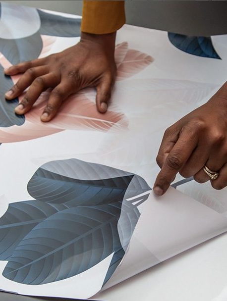
All our wallpapers are custom printed to order and arrive at you, literally hot off the press. We have added a bleed to your 50cm (width) design to allow for easy line up with no wall gaps. As well as this we have a handy margin along the left hand side of your wallpaper to guide the line up of your design making it that much easier to DIY.
The reasons above together with our prices make WallpaperOnline the best wallpaper you can buy online in South Africa.
Please note:
*Wallpapers will be printed with a width of 50cm, as a repeating pattern.
* Murals are printed in panels of 50cm wide that once installed will create one big picture on the wall.
**We manufacture your order especially for you, please order enough for your wall space as we cannot guarantee that the colour will match exactly if a “top up” order is made at a later date.
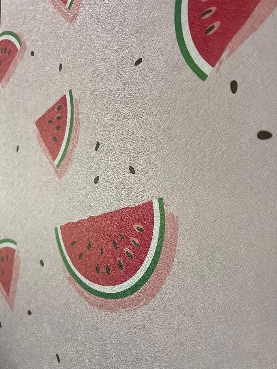
- Commercial grade, textured PVC self adhesive wallpaper. -Waterproof & washable. - Repositionable & removable.
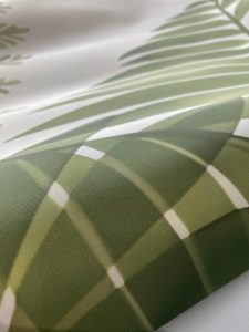
- Commercial grade fabric wallpaper. - Waterproof and washable. - Requires glue to apply.
- Soft touch smooth matte texture. - Peel & stick / self-adhesive wallpaper with backing paper (like a big sticker). - Waterproof & washable. -
- Traditional non-woven paper wallpaper. - Wipe-able but not waterproof or washable. - Requires glue to apply.
The South African Map Mural is a meticulously detailed representation of the nation’s nine provinces and key urban centers. Designed with a bright, multi-colored aesthetic, each region is clearly demarcated to provide a legible and engaging visual experience. This mural effectively combines cartographic accuracy with modern design, making it an ideal choice for educational environments in Johannesburg, corporate boardrooms in Toronto, or travel-themed rooms in New York.
Beyond its utility as a map, the high-contrast labels and clean linework offer an organized, professional appearance that fits various interior styles. Whether you are teaching geography or celebrating your roots, this large-scale mural provides a captivating window into the heart of Southern Africa.
Educational Detail: Includes all provincial borders, major cities, and neighboring countries for comprehensive geographic reference.
Vibrant Color-Coding: Uses a distinct palette of greens, yellows, and oranges to differentiate provinces, enhancing scannability.
Durable Print: Produced on high-grade, non-woven substrate that is scratch-resistant and easy to clean in high-traffic areas.
Custom Dimensions: Available in scalable sizes to ensure a perfect fit on any feature wall, from small home offices to large classroom displays.
| Weight | 2 kg |
|---|---|
| Mural Materials | DuraMatte Fabric Wallpaper, Peel & Stick, Traditional Non-Woven Wallpaper |
| size | |
| Bathroom Friendly? | DuraMatte Fabric: Yes, Peel & Stick: Yes, Traditional: No |
| Application | DuraMatte Fabric: Requires wallpaper glue or paste, Peel and Stick: Self Adhesive-peel off backing Traditional: Requires wallpaper glue or paste |
| Delivery | 4-5 Working days for manufacturing and then approximately 2 working days for courier. |
| Texture / Finish | DuraMatte Fabric: cotton canvas fabric texture / off white grey hue, Peel and Stick: soft touch matte / pure white., Traditional: paper matte / off white warm hue. |
| Washability | DuraMatte Fabric: Can be washed with warm water, gentle soap and a soft cloth., Peel and Stick: Can be washed with warm water, Traditional: Can be wiped. |
| Country of Origin | All murals made in South Africa |
WallpaperOnline © 2024 The Brand Cartel | Terms & Conditions | Returns Policy


Reviews
There are no reviews yet.